



shape

Highly Accurate Catalogue

We deliver clear, data-driven solutions for the complex world of space. At the heart of effective Space Situational Awareness (SSA) lies a highly accurate orbital catalogue. Without precise, up-to-date information on what objects are in space, their past paths and their latest observed positions, even the most advanced algorithms and brilliant experts can’t protect your assets. An SSA catalogue is a living system. It continuously integrates fresh tracking data and refines its contents through rigorous correlation checks, ensuring you always have the clearest possible picture of the space environment.

shape

Assess Vulnerability & Protection

Quickly determine the collision risk or threat level of any object with our precise vulnerability assessments and receive customised, real-time alerts tailored to your needs. Perform this analysis instantly and simultaneously across your entire constellation, delivering mission-critical assurance for every operational asset — whether in LEO, MEO, GEO, or highly elliptical orbits. Covering all scenarios (LEO-to-LEO, GEO-to-GEO, LEO-to-GEO and everything in between), our system ensures you stay ahead of potential threats, protecting your space-based systems with confidence and clarity.

shape

Performance

As the number of objects in orbit continues to grow rapidly — with mega-constellations and new launches adding thousands more every year — the computing power needed to track, predict, and analyse every piece of data increases exponentially. Yet Magnus processes and computes orbital data for more than 200,000 objects with virtually no loss in performance. This exceptional efficiency means you get accurate, real-time insights even as the space environment becomes more crowded and complex — keeping your situational awareness sharp when it matters most.

shape

Our Mission

Our mission is to deliver transparent, actionable awareness of the space environment and enable responsible, secure, and sustainable use of Earth orbit. We turn complex space data into clear, real-time insight so satellite operators, launch providers, and governments can avoid collisions, protect assets, reduce debris risks and operate with confidence. Our accurate, constantly updated catalogue and intuitive tools provide the clarity needed to navigate today’s crowded orbits safely. A sustainable space future begins with knowing exactly what’s up there — and acting responsibly on that knowledge.

Our Services

Track with Precision 01

Monitor objects across every orbital regime using accurate, real-time space domain intelligence:

From crowded LEO to strategic GEO, MEO and cislunar space, you need instant visibility of every object and risk. Our global sensor network and advanced fusion engines track over 200,000 objects daily – satellites, debris and rocket bodies in LEO. Fresh observations are processed in seconds and merged into one continuously updated catalogue. You receive precise positions, velocities, conjunction warnings, manoeuvre alerts and re-entry forecasts in real time, across all regimes. The system scales effortlessly, delivering clear, actionable insights via dashboards or API without delay. In an increasingly congested orbit, this trusted, end-to-end awareness keeps your assets safe and operations sustainable.
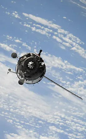

Orbital tracking across LEO, MEO and GEO

Identify collision threats and critical events before they escalate, enabling timely, informed decisions:

Thousands of objects zip through orbit — one missed close approach can spell disaster. Our system continuously screens every tracked object against your satellites and instantly flags high-risk conjunctions, delivering clear alerts with collision probability, time of closest approach and recommended action windows. We also catch fragmentations, unexpected decays, re-entries and manoeuvres. Alerts arrive within minutes, giving your team the lead time needed to assess risks and perform avoidance manoeuvres confidently. Early, accurate warnings keep your assets safe and space sustainable.

Conjunction risk assessment and early warning

See the orbital picture behind every number, so a decision can be checked and not only taken:

A probability on its own is hard to act on. Our visualisation turns the catalogue into a picture you can interrogate: where your satellites sit among the objects around them, how an encounter geometry develops, and what changes once a manoeuvre is applied. Views cover LEO through MEO, GEO and cislunar space, and refresh as new observations arrive. Everything on screen is available through the same API and in scheduled reports, so the picture your operators read is the picture you can share with partners and agencies.

Visualisation of the orbital domain

In a domain where split-second decisions can save or lose critical assets, confidence isn’t a luxury — it’s everything:

We develop customised strategies that incorporate tactics proven to deliver outstanding results through years of real-world testing. Working closely with your team, we craft collision avoidance processes that perfectly match your mission profile, risk tolerance and operational rhythm. Every threshold, every workflow, every recommendation is built on methods that have successfully resolved hundreds of high-risk events. You gain fewer false alerts, clearer decision paths, lower workload and the certainty that your assets are protected by the smartest, most reliable approach available. Operate with confidence — knowing your strategy isn’t just theoretical, it’s proven in orbit, every single day.

Operations team working with live catalogue data

We deliver data-leading innovation and insights modules, while staying true to our mission: building autonomous space domain systems that allow anybody to operate safely in Space.

Our user-centred SSA platform drives operational efficiency

  • Deliver crystal-clear awareness of the space environment
  • Tailored collision-avoidance strategies and consultation
  • Align your team with a shared, actionable mission
  • Provide precise, real-time insights so every decision is informed and confident
Learn More

Central Space Agency has transformed our Space Situational Awareness (SSA) capabilities. Their proprietary catalogue is significantly sharper, faster, and more accurate than any public sources, with false alarms dramatically reduced and every conjunction alert clear, reliable and immediately actionable. The CSA team expertly tailored the system to our constellation and provides lightning-fast support. It delivers true peace of mind for our orbital operations—we highly recommend them.

Turning Space Data into Real-World Advantages

Sharper SSA for safer Orbits

  • 200k+

orbital data of objects processed

Curious about something? Just ask us!

Central Space Agency is your dedicated partner for Space Situational Awareness and orbital safety. Whether you have questions about our SSA data services, conjunction alerts, custom catalogue access or tailored support for your constellation—our team is here to help. For any inquiries, feel free to email us!

Frequently Asked Questions

The primary goals of 'Central Space Agency' are to advance and ensure safe and sustainable access to orbit for all nations and operators, to foster international collaboration on exploration and research and to develop technologies while protecting the orbital environment.

We engage with you in the way that best fits your operations — seamlessly and without friction. You can access our real-time catalogue, alerts and analytics, receive automated notifications via email or secure messaging, pull data instantly through our REST API or integrate everything deeply into your own systems. Our team is always available with direct support, regular performance reviews and on-demand assistance—delivering exactly the level of interaction your operations require, precisely when you need it.

Right now, Space Situational Awareness faces major challenges: orbits are rapidly filling with satellites and debris creating a real risk of cascading collisions; small, dangerous fragments remain untrackable; computing demands are exploding while many systems can’t keep up. Together, these issues make safe operations increasingly difficult and raise the chance of losing access to critical orbits within years if nothing changes.

We bridge the data-sharing gap by acting as a trusted intermediary. Any reliable sensor owner can contribute data under strict confidentiality, while we fuse it all into a far more accurate catalogue. We fill critical gaps and foster valuable partnerships.

Tell us what you are protecting.

Send us your mission profile and we will come back with a concrete answer about coverage, screening thresholds and lead times — not a brochure.